
My advice is to start early. I didn’t get the first bus, but was on the 0900 one. You take the metro to the Autobuses del Norte metro station. The pyramid bus tickets could be bought near Puerta (door) 8. There are signs with the Teotihuacan pyramids. Buy a round trip, and make sure you don’t miss your departing bus. The ticket is only valid for that one. I think it cost 100 pesos or so. Ask which bay the bus will be in, I found the signage lacking. https://sightdoing.net/how-to-visit-teotihuacan-without-a-tour/
The trip isn’t quick. Bring a book or something to do. It’s a good idea to bring water too. I visited in the middle of November and got sunburnt standing on the pyramids for most of the day.
The gatehouse is a short walk to the front entrance. Tickets were 100 pesos most recently that I checked.
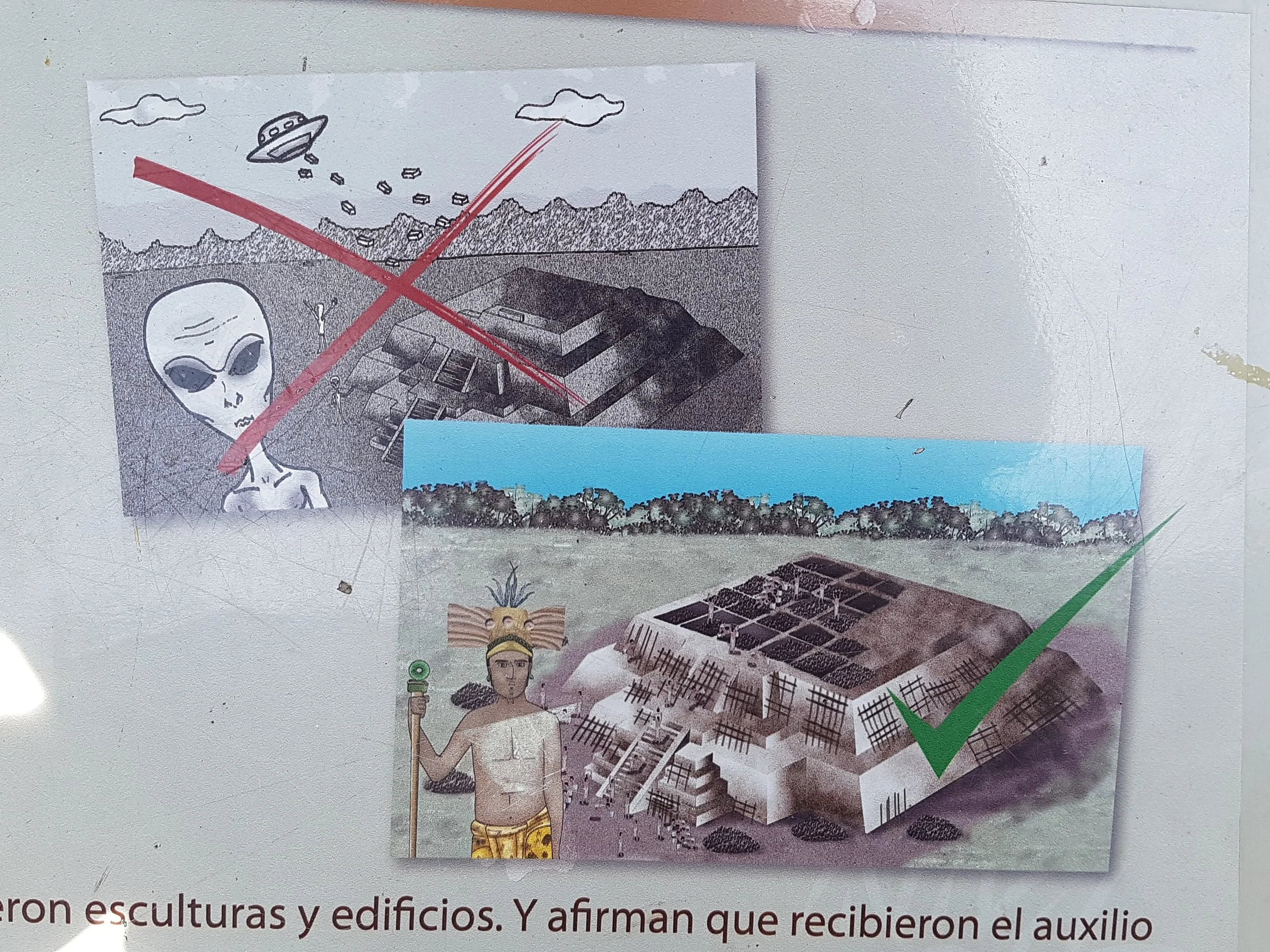
Excerpts from “Fingerprints of the Gods” by Graham Hancock (Chapter 22) that I found fascinating:
“What Harleston’s investigations had shown was that a complex mathematical relationship appeared to exist among the principal structures lined up along the Street of the Dead (and indeed beyond it). This relationship suggested something extraordinary, namely that Teotihuacan might originally have been designed as a precise scale-model of the solar system. At any rate, if the centre line of the Temple of Quetzalcoatl were taken as denoting the position of the sun, markers laid out northwards from it along the axis of the Street of the Dead seemed to indicate the correct orbital distances of the inner planets, the asteroid belt, Jupiter, Saturn (represented by the so-called ‘Sun’ Pyramid), Uranus (by the ‘Moon’ Pyramid), and Neptune and Pluto by as yet unexcavated mounds some kilometres farther north.
If these correlations were more than coincidental, then, at the very least, they indicated the presence at Teotihuacan of an advanced observational astronomy, one not surpassed by modern science until a relatively late date. Uranus remained unknown to our own astronomers until 1787, Neptune until 1846 and Pluto until 1930. Even the most conservative estimate of Teotihuacan’s antiquity, by contrast, suggested that the principal ingredients of the site-plan (including the Citadel, the Street of the Dead and the Pyramids of the Sun and the Moon) must date back at least to the time of Christ. No known civilization of that epoch, either in the Old World or in the New, is supposed to have had any knowledge at all of the outer planets – let alone to have possessed accurate information concerning their orbital distances from each other and from the sun.”
“There was no archaeological evidence that this enormous enclosure had ever served as a citadel – or, for that matter, that it had any kind of military or defensive function at all. Like so much else about Teotihuacan it had clearly been planned with painstaking care, and executed with enormous effort, but its true purpose remained unidentified by modern scholarship.28 Even the Aztecs, who had been responsible for naming the Pyramids of the Sun and the Moon (an attribution which had stuck though no one had any idea what the original builders had called them) had failed to invent a name for the Citadel. It had been left to the Spaniards to label it as they did – an understandable conceit since the 36-acre central patio of La Ciudadela was surrounded by massively thick embankments more than 23 feet high and some 1500 feet long on each side.”
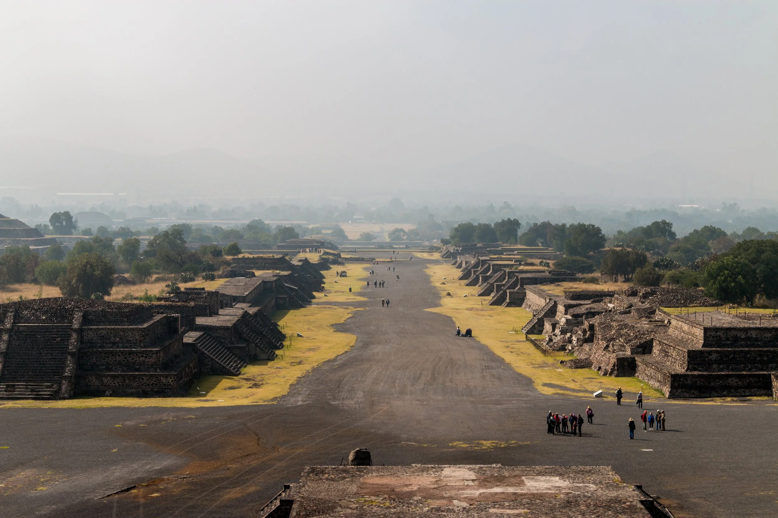
“My walk had now brought me to the western extreme of the patio. I climbed a steep set of stairs that led to the top of the embankment and turned north on to the Street of the Dead. Once again I had to remind myself that this was almost certainly not what the Teotihuacanos (whoever they were) had called the immense and impressive avenue. The Spanish name Calle de los Muertos was of Aztec origin, apparently based on speculation that the numerous mounds on either side of the Street were graves (which, as it happened, they were not).
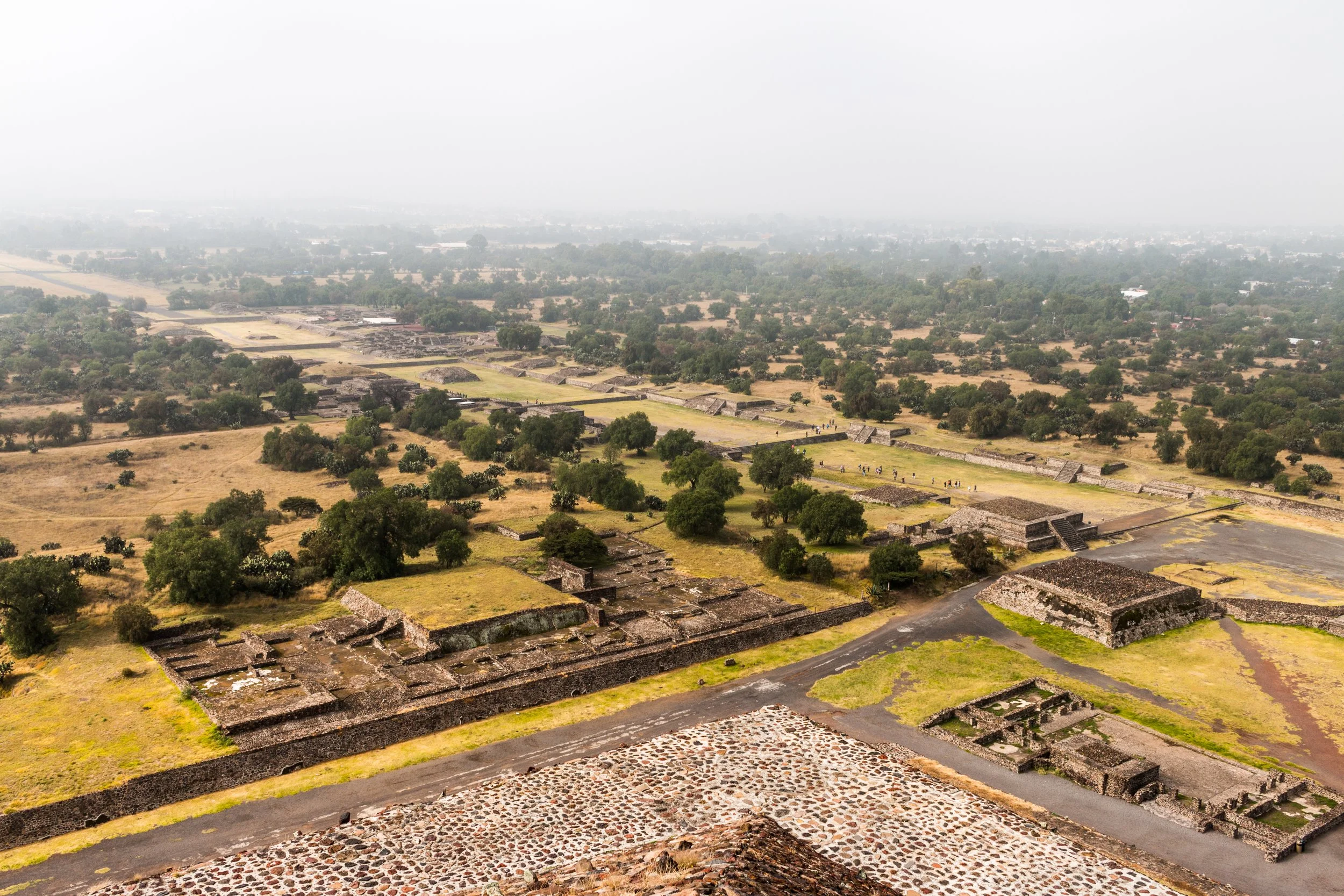
As I walked steadily northward towards the still-distant Moon Pyramid, it seemed to me that this theory had several points in its favour. For a start the ‘Street’ was blocked at regular intervals by high partition walls, at the foot of which the remains of well-made sluices could clearly be seen. Moreover, the lie of the land would have facilitated a north-south hydraulic flow since the base of the Moon Pyramid stood on ground that was approximately 100 feet higher than the area in front of the Citadel. The partitioned sections could easily have been filled with water and might indeed have served as reflecting pools, creating a spectacle far more dramatic than those offered by the Taj Mahal or the fabled Shalimar Gardens. Finally, the Teotihuacan Mapping Project (financed by the National Science Foundation in Washington DC and led by Professor Rene Millon of the University of Rochester) had demonstrated conclusively that the ancient city had possessed ‘many carefully laid-out canals and systems of branching waterways, artificially dredged into straightened portions of a river, which formed a network within Teotihuacan and ran all the way to [Lake Texcoco], now ten miles distant but perhaps closer in antiquity’.”
Excerpts from “Teotihuacan: an early urban center in its regional context” - By Sarah C. Clayton (2015):
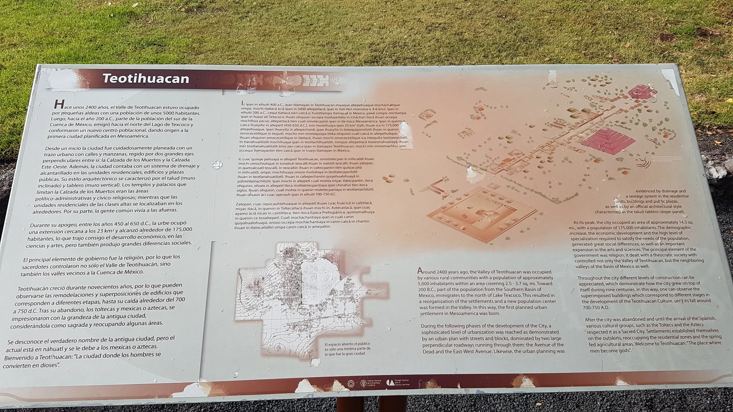
“The first century BCE in the northeastern Basin of Mexico witnessed the emergence of Teotihuacan, a city that rapidly developed into the capital of a regional state of unprecedented size, monumentality, ethnic and social diversity, and political power in the Mexican Highlands. Teotihuacan was a “primate” center, its peak population of more than 100,000 people dwarfing that of all contemporaneous settlements in the region. A varied mosaic of farmers, craft specialists, merchants, and immigrants resided in the 20-square-kilometer area identified as the urban zone of Teotihuacan. Teotihuacan’s population was not limited, however, to the capital; it also extended to several rural settlements from which the state derived many resources necessary for sustaining the urban population. Teotihuacan extended its influence to such far-flung regions as the Gulf and Maya Lowlands, west Mexico, Oaxaca, and the Maya Highlands, engaging in interregional relations that likely ranged from occasional diplomatic interaction to political manipulation through acts of conquest. After flourishing for more than six centuries, Teotihuacan’s political prominence and elite institutions had irrevocably dissolved by around 650CE. Although its eminence was probably waning by the sixth century, Teotihuacan’s eventual end was marked by calamitous events, as the city’s central monuments and residences were violently attacked and burned. The city continued to be inhabited, supporting a relatively large population of perhaps 40,000, but it was never again to wield the degree of regional political power or interregional influence that it had previously achieved.”
“Researchers seeking to elucidate the structure of government at Teotihuacan have looked primarily to its most prominent monumental complexes for material evidence – the Pyramid of the Moon, the Pyramid of the Sun, and the Ciudadela, a large enclosure within which the Feathered Serpent Pyramid was situated. Governance at Teotihuacan remains enigmatic, and no buried ruler has ever been located within any of these monuments or elsewhere at Teotihuacan. Large-scale excavations at the Feathered Serpent Pyramid and the Pyramid of the Moon have uncovered the remains of elaborate rituals of offering and sacrifice. These offerings include predatory animals (Burial in the Pyramid of the Moon, for example, includes pumas, birds of prey, rattlesnakes, and a wolf) as well as staggering numbers of human victims, many of whom appear to have been highly decorated warriors. These important projects have contributed to a clearer picture of the military might of the Teotihuacan state, but no individual inhumed in these monuments has ever been identified as a ruler. Moreover, there are no clear depictions of rulers in the large body of art and sculpture that has been recovered from the ancient city. The absence of depictions of glorified individuals suggests that rulership at Teotihuacan differed from that of other Mesoamerican states. The Maya, for example, were prolific in producing monuments commemorating the accomplishments of specific rulers.”
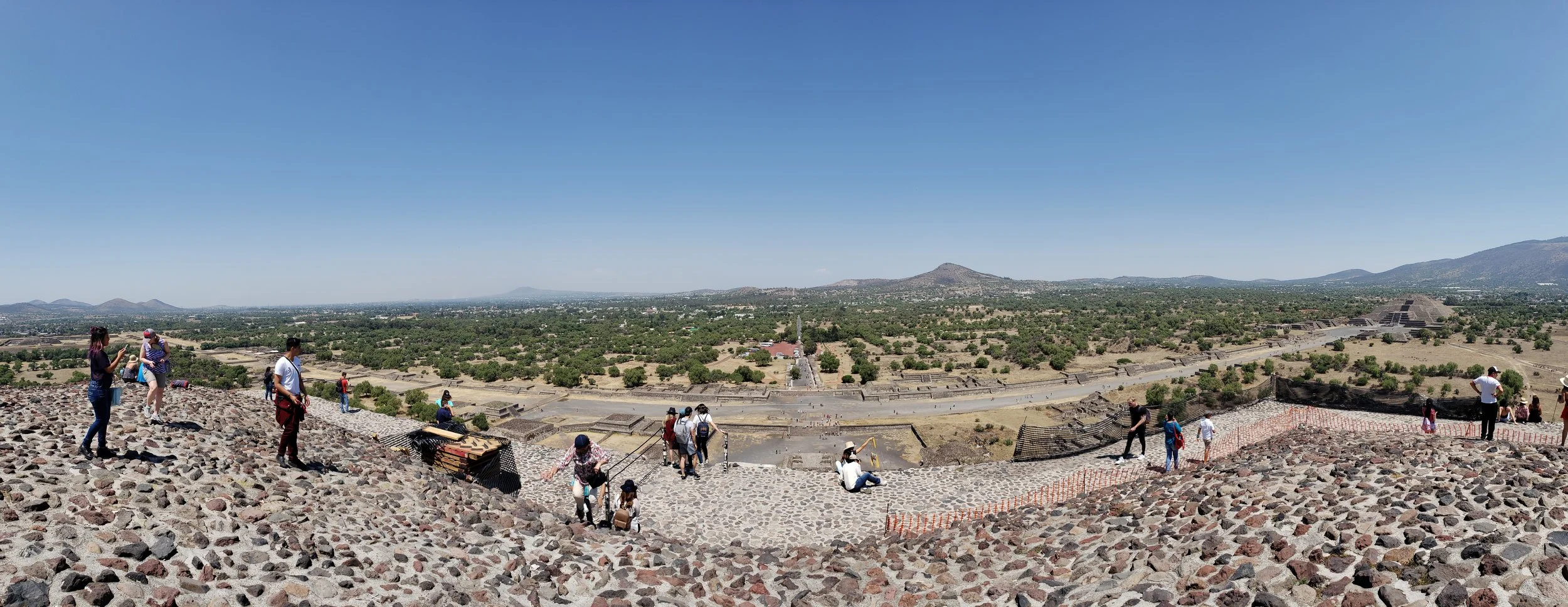
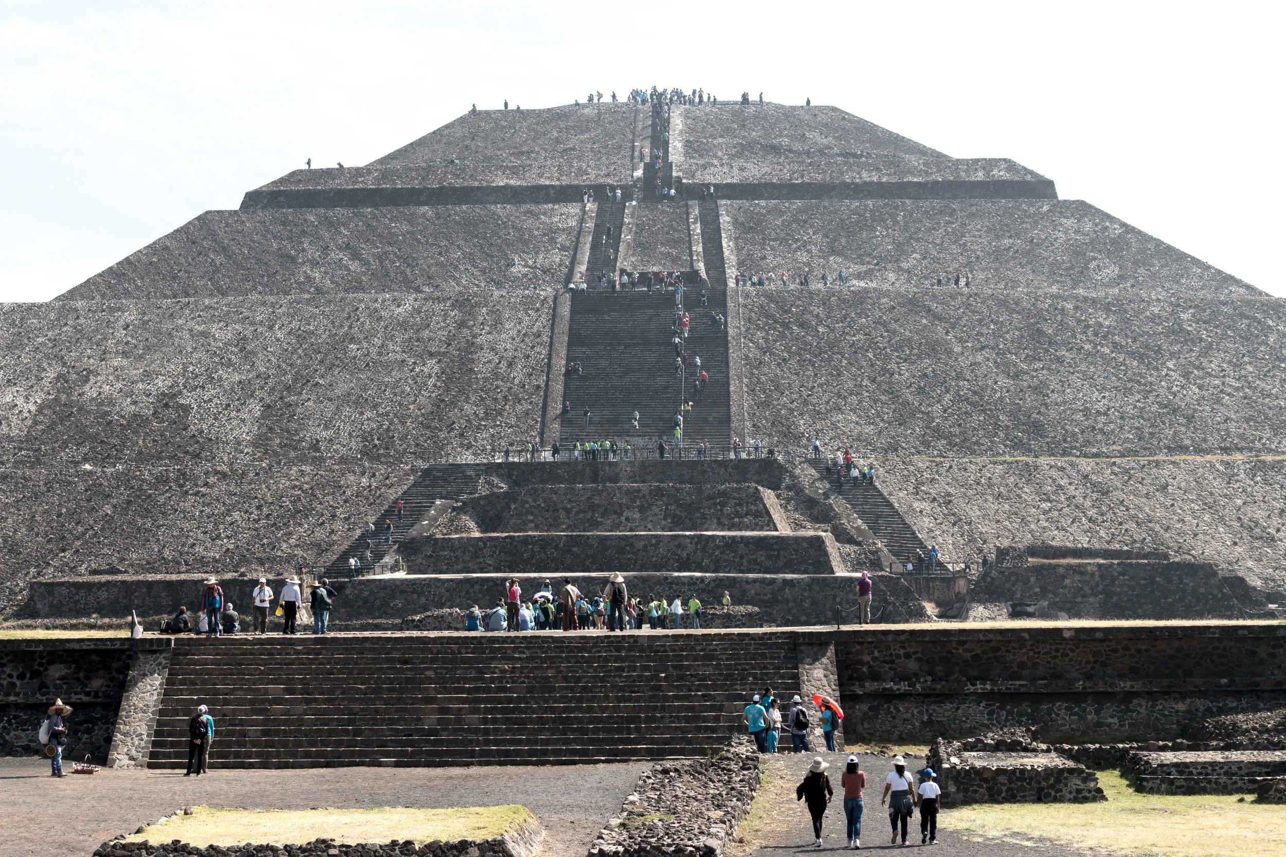
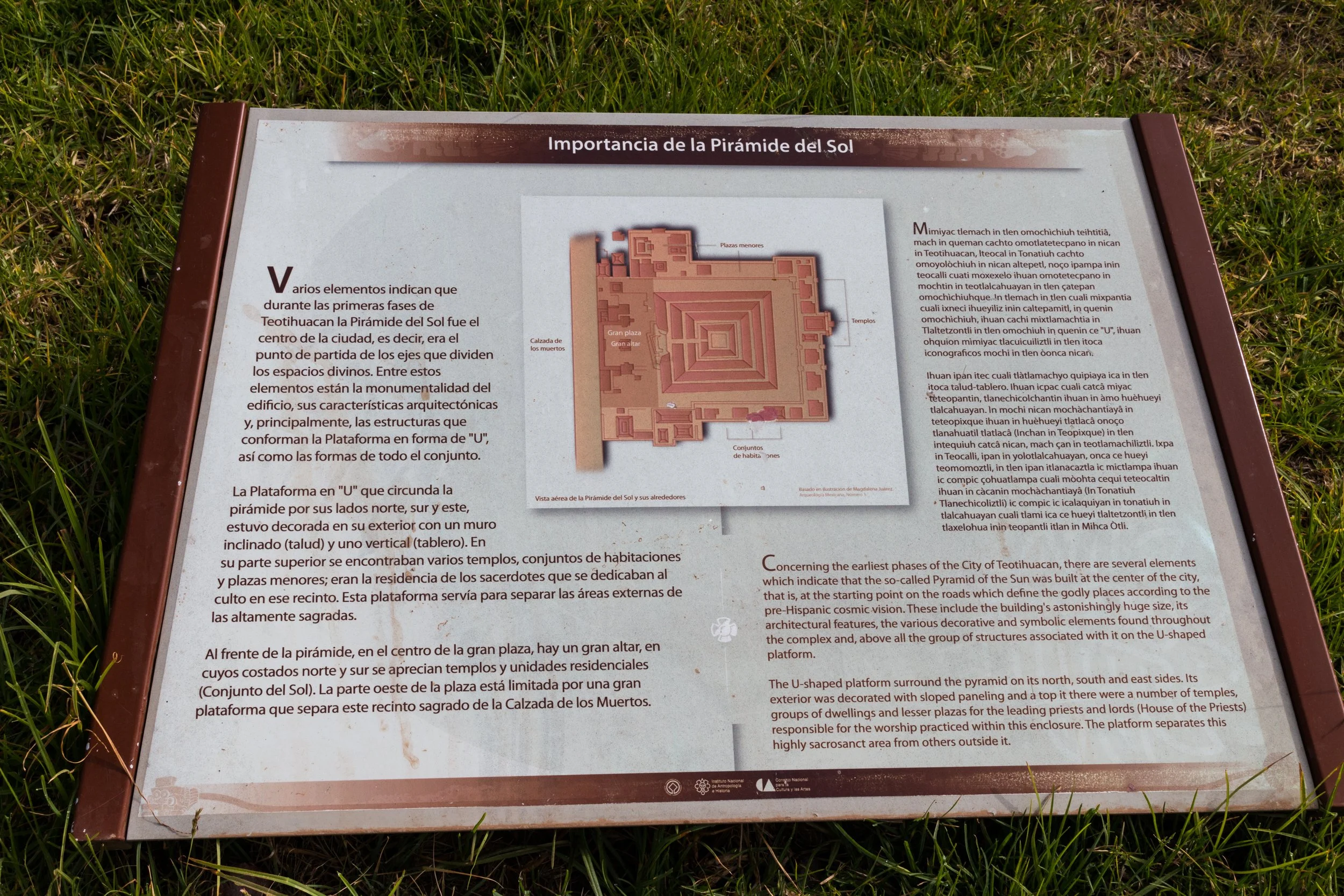
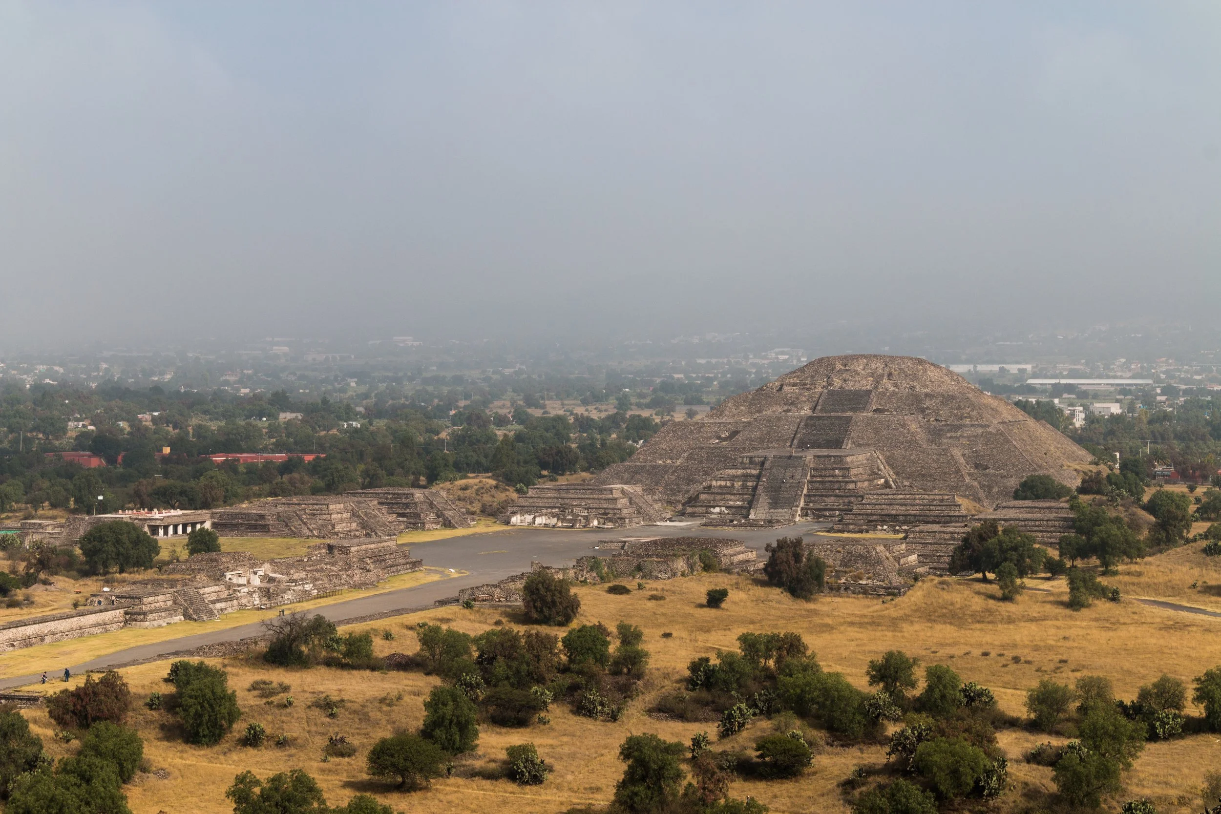
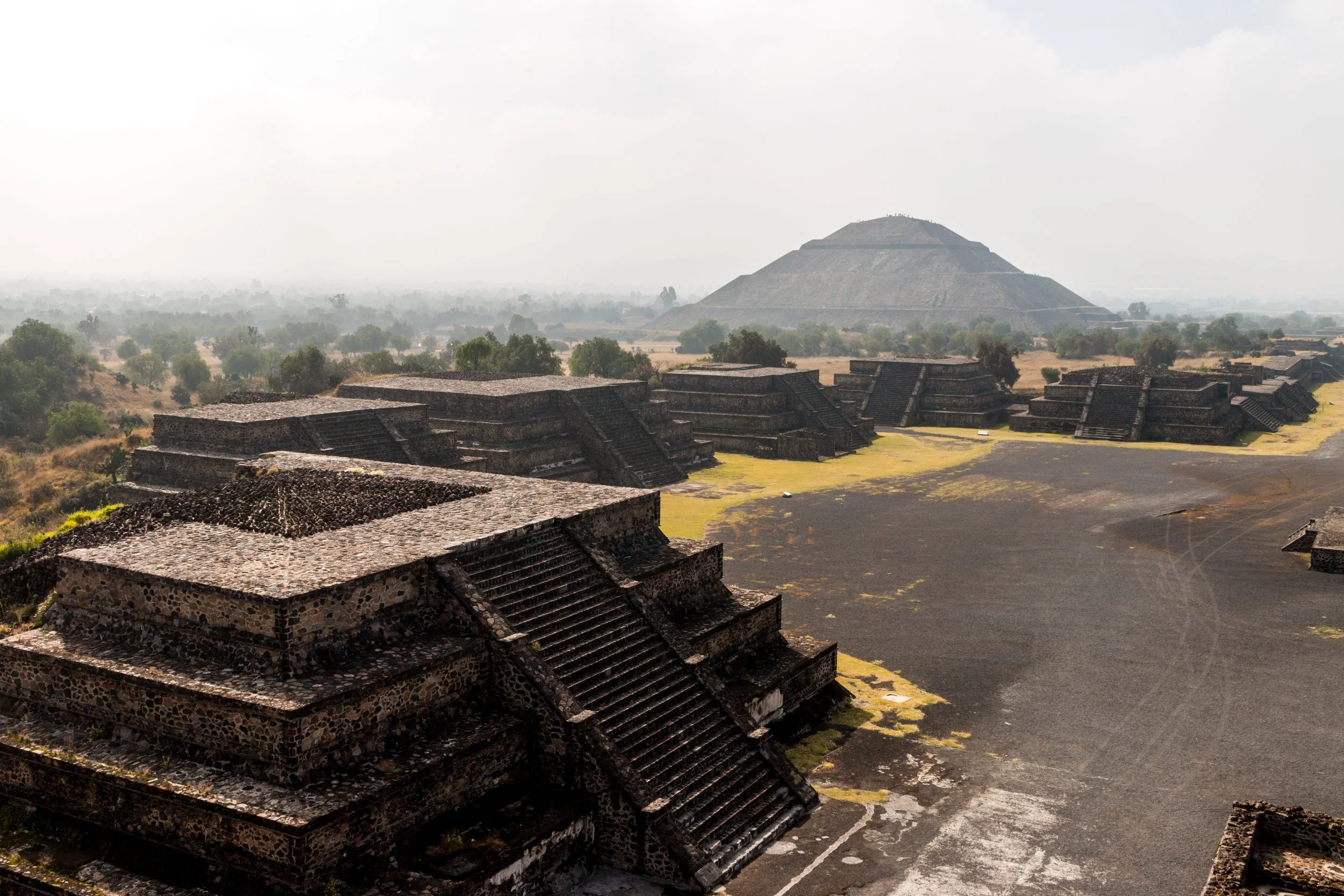
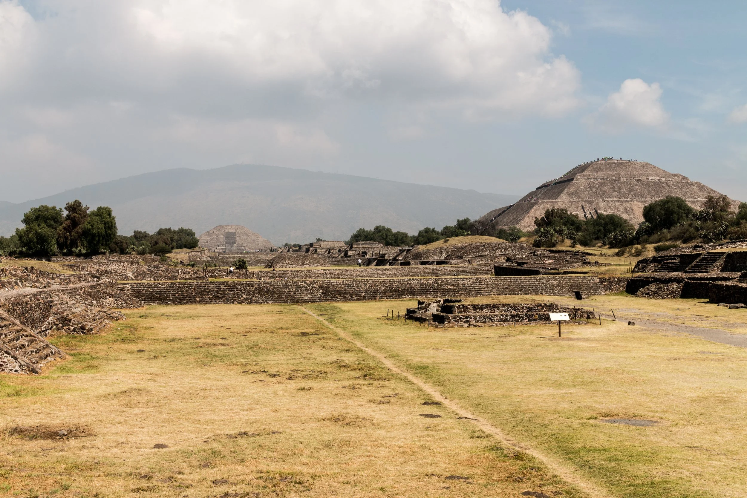
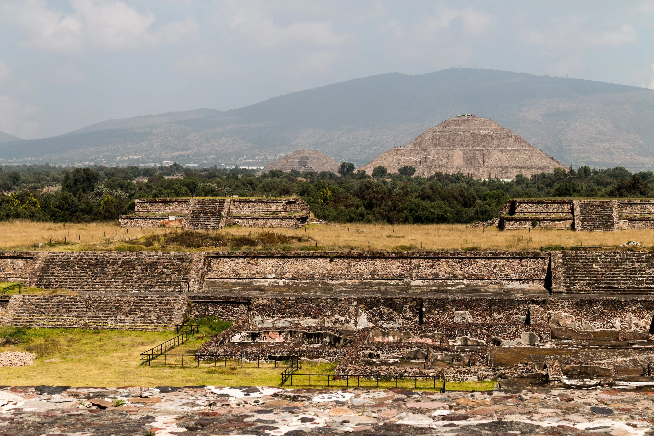
Pyramide del Sol - The Pyramid of the Sun
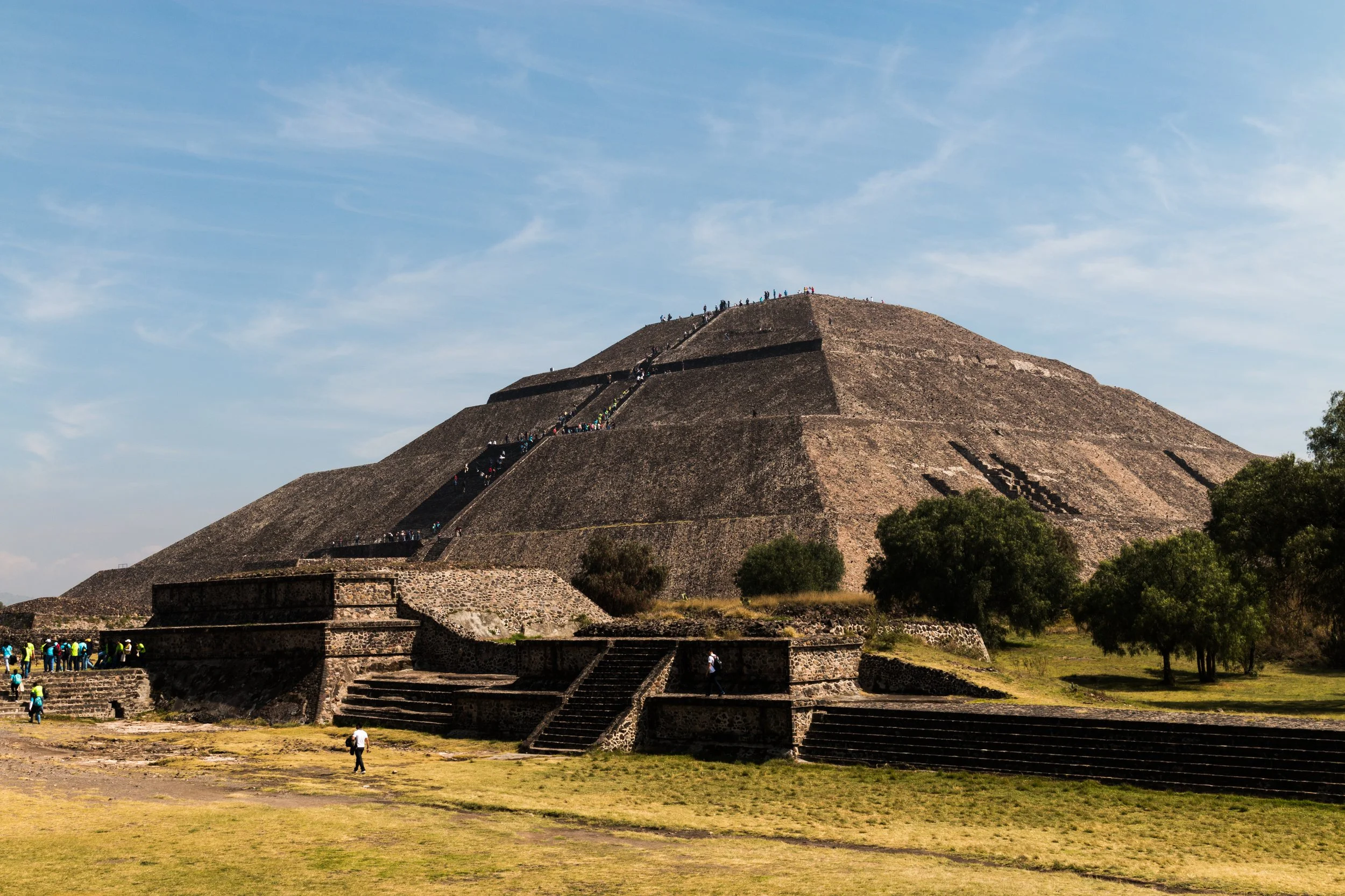
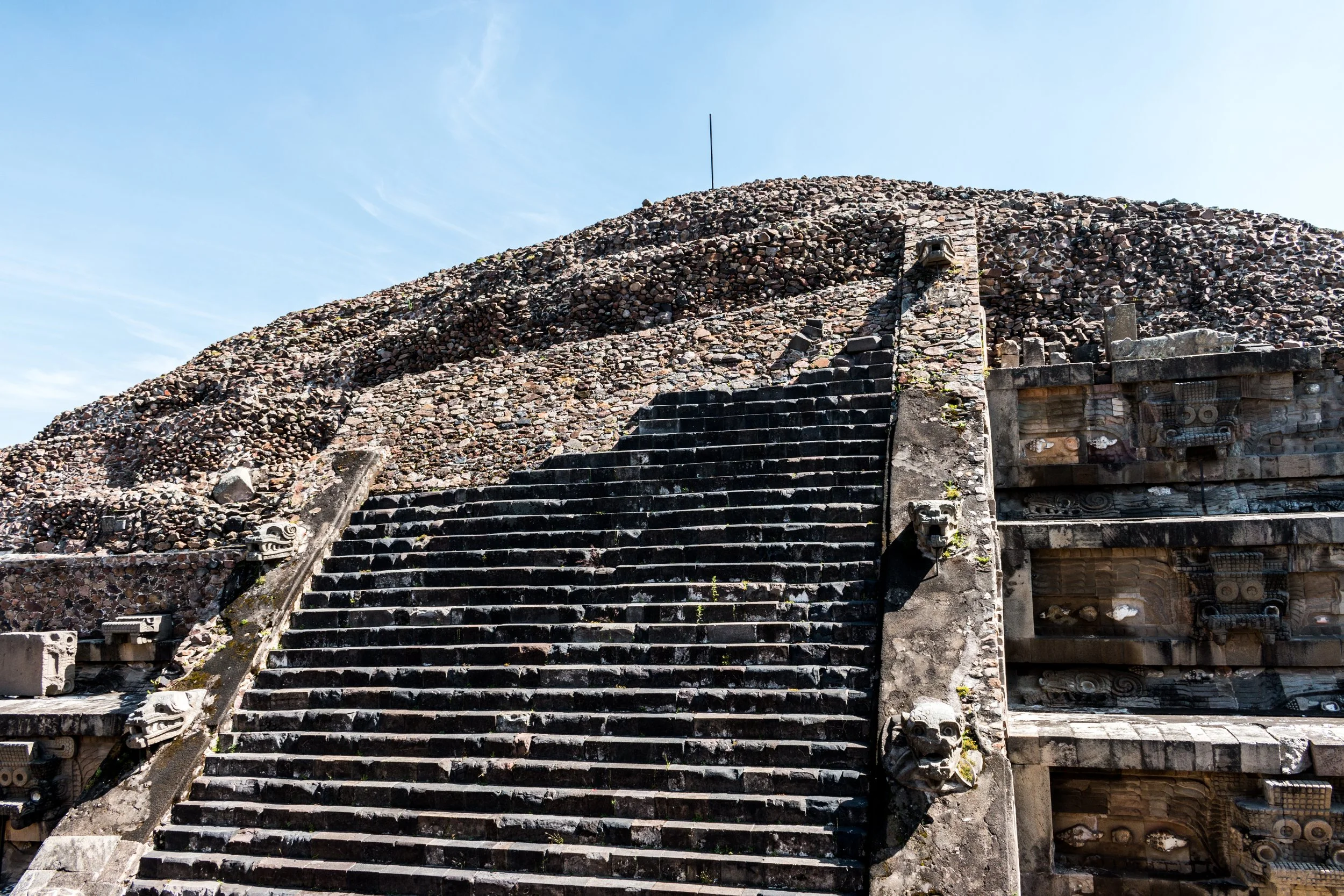
Once inside you should head straight up the Pyramide del Sol by turning left (Note: I have read that you are unable to climb the Pyramid of the Sun now). The steep steps in the high altitude might be more difficult than you expect. Be aware that people will all want their photos taken and the selfie sticks will be out on top. So long as you arrive early enough, the tours won’t be filing the area, so enjoy the peace.
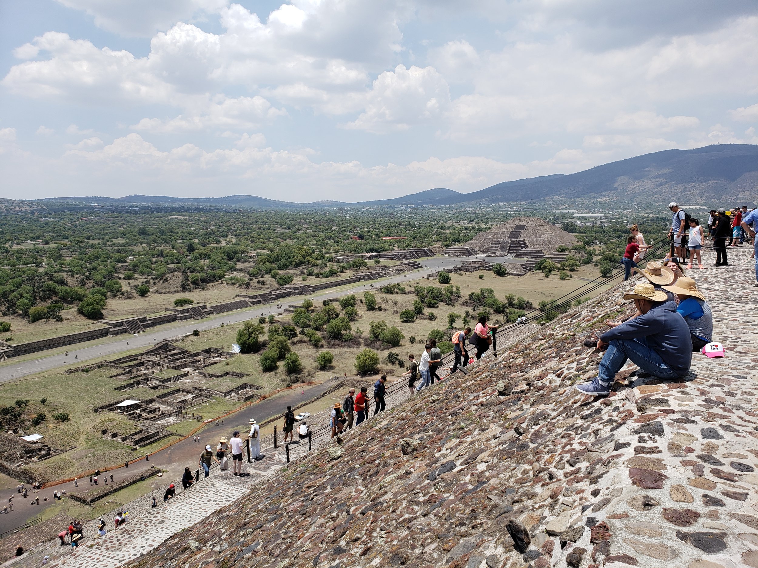
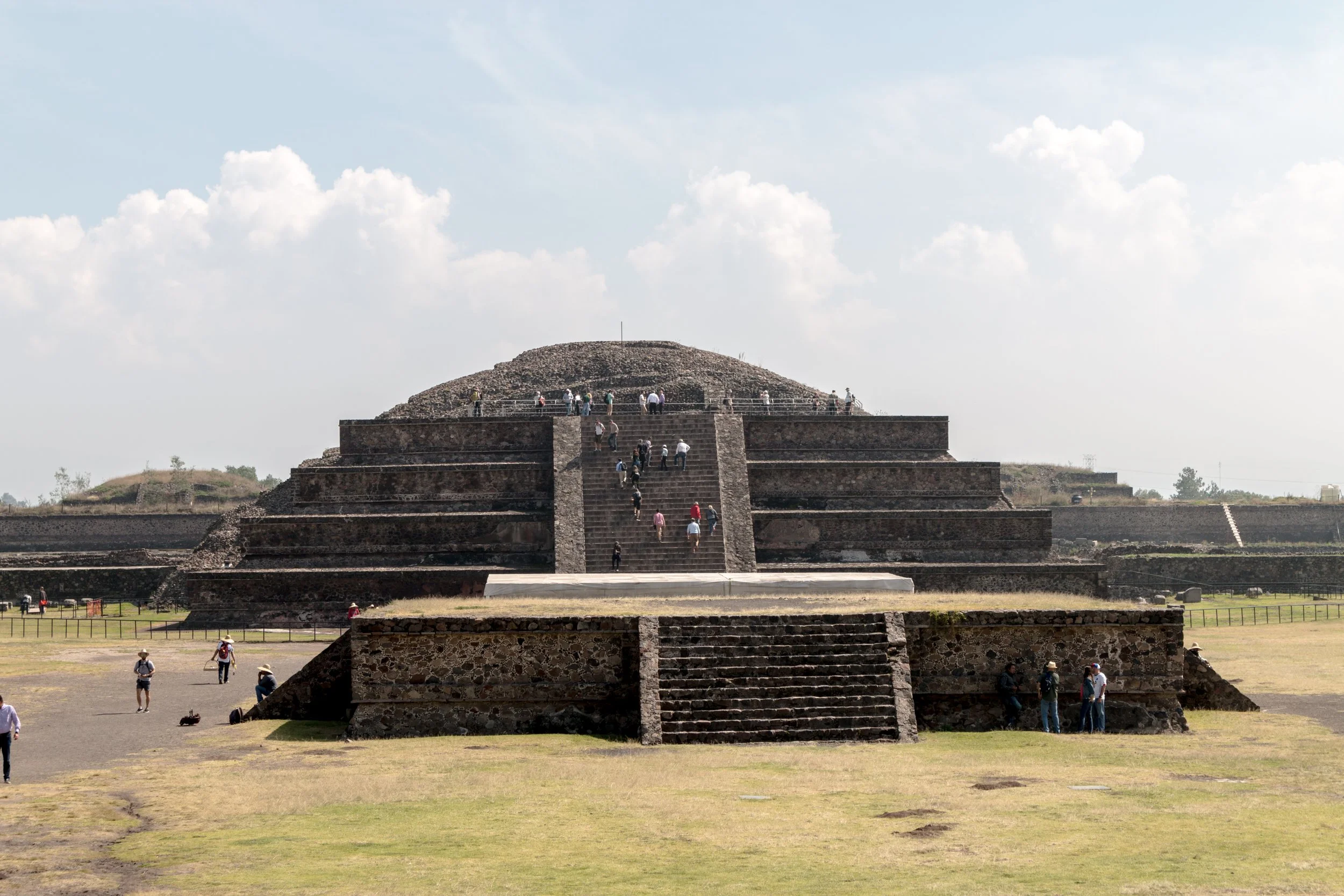
Piramide de la Luna - The Pyramid of the Moon
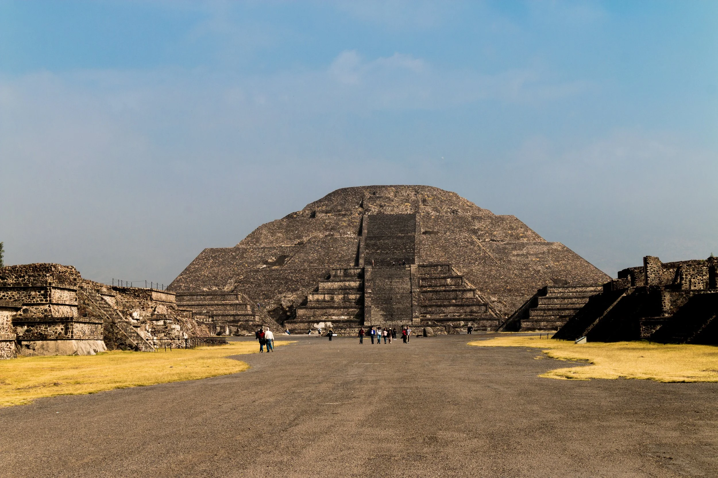
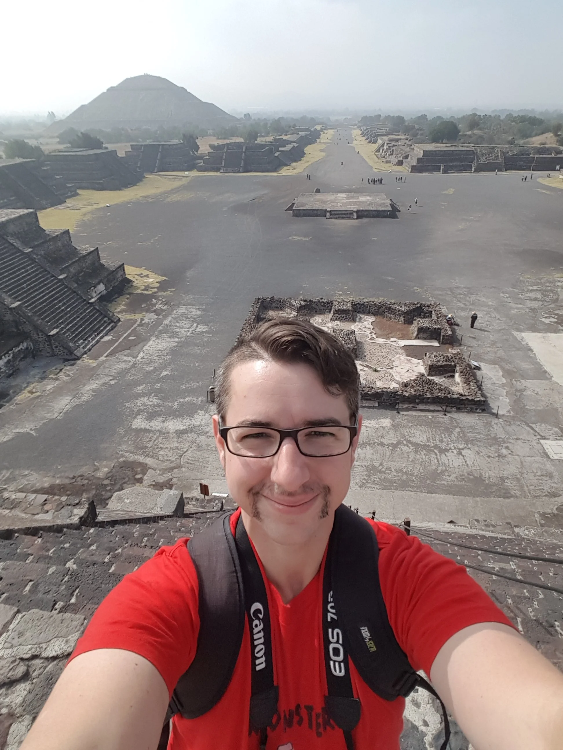
From the Pyramid of the Sun, I went directly to the Piramide de la Luna. You can only walk half way up, and this is also steep. But the views are special in their own right.
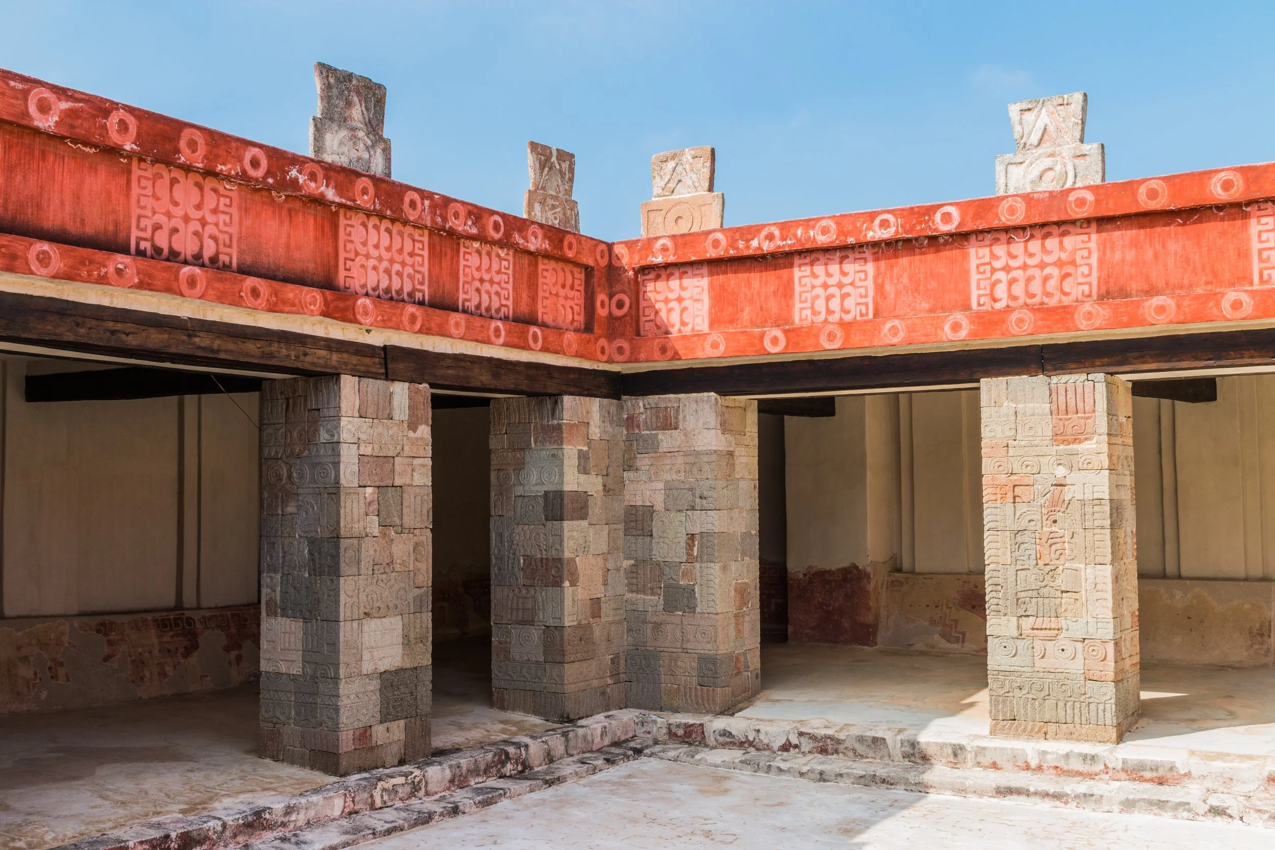
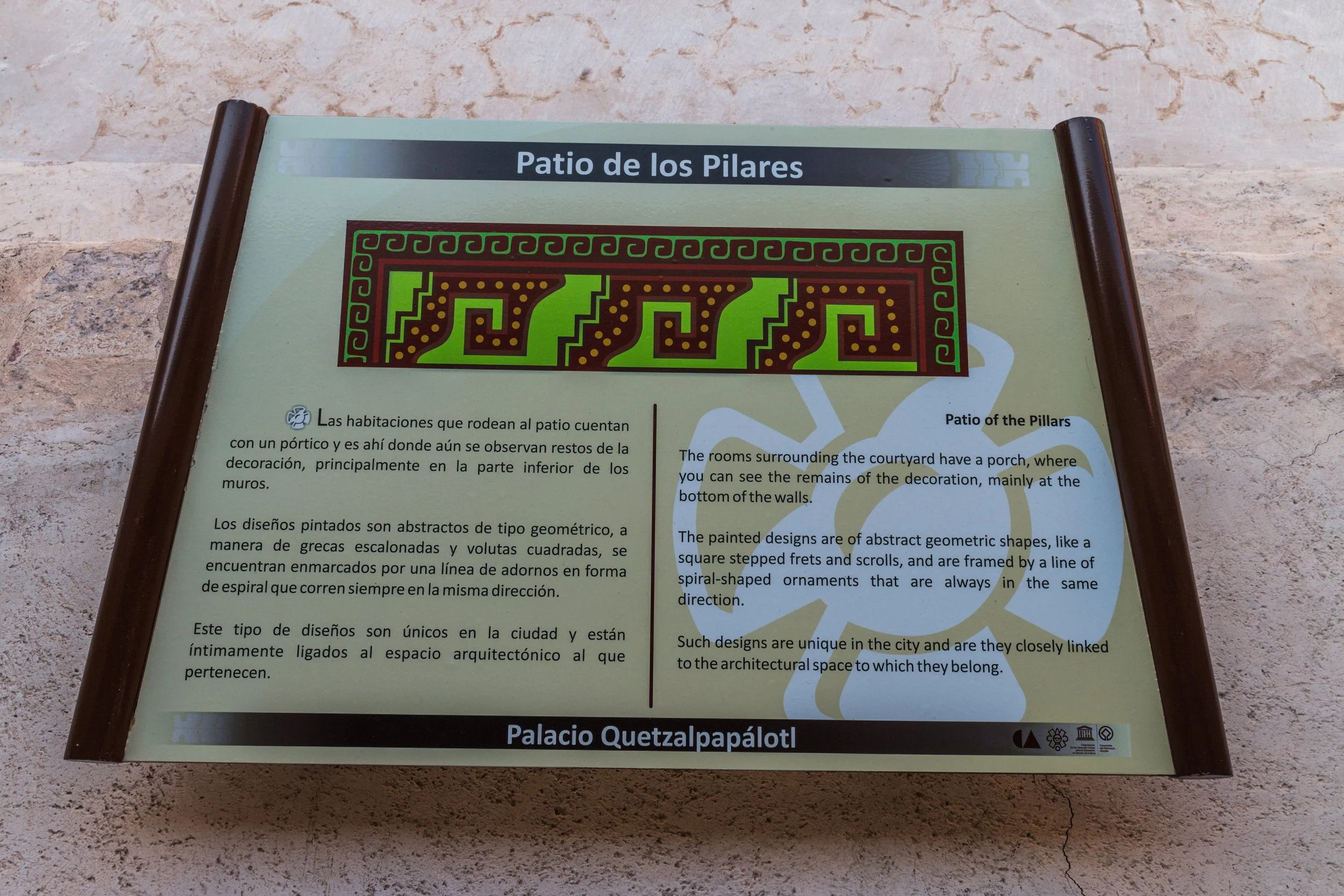
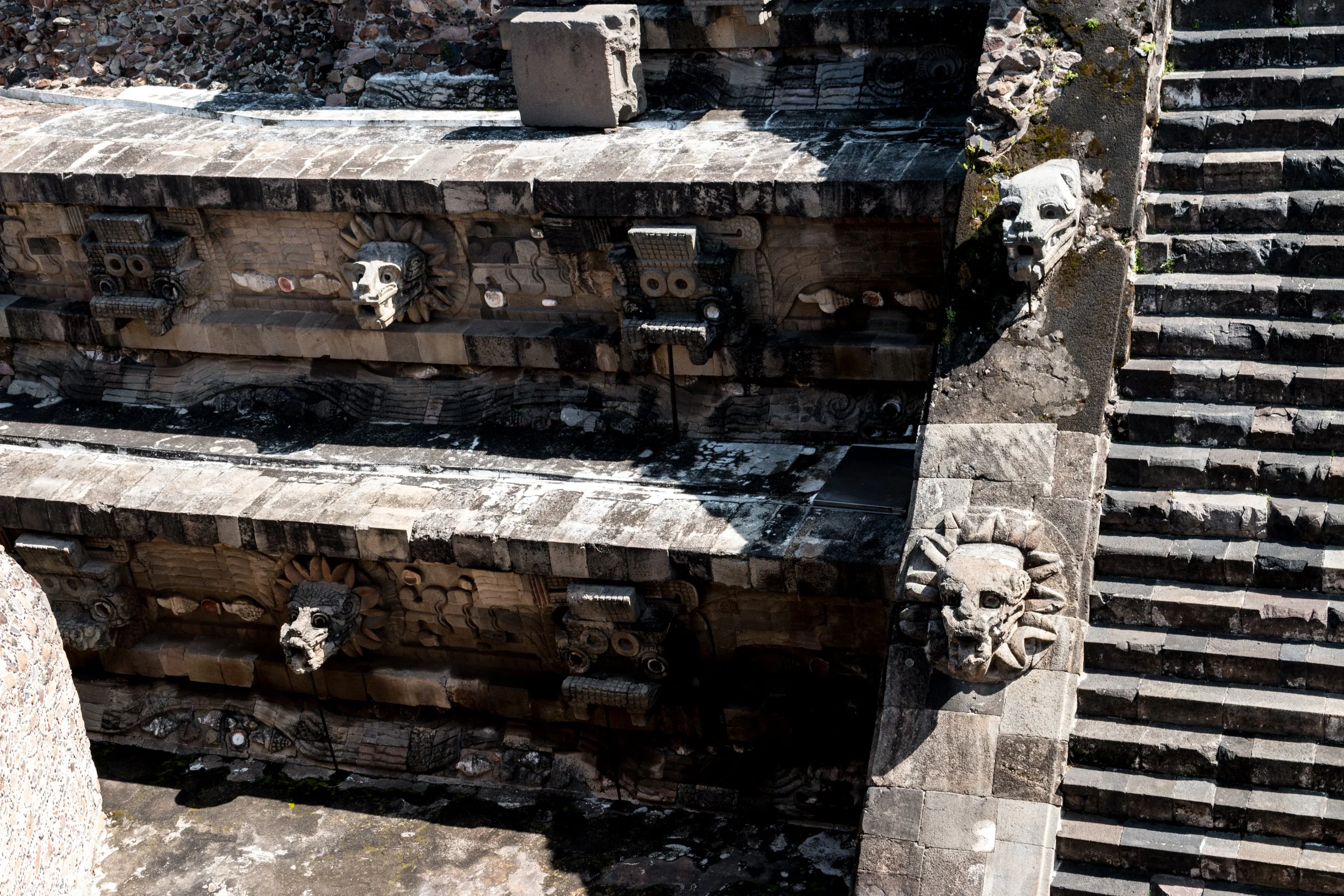
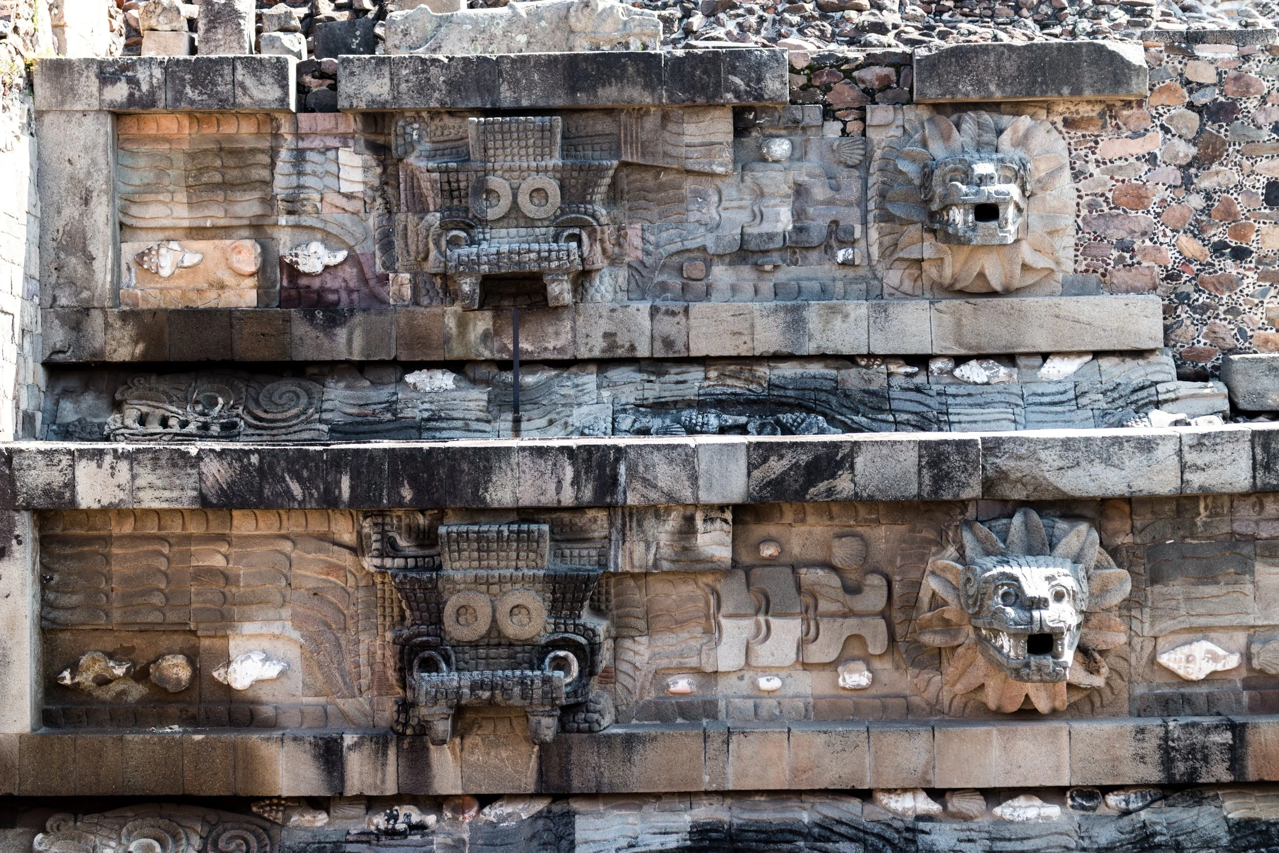
Palacio de Quetzalpapálotl
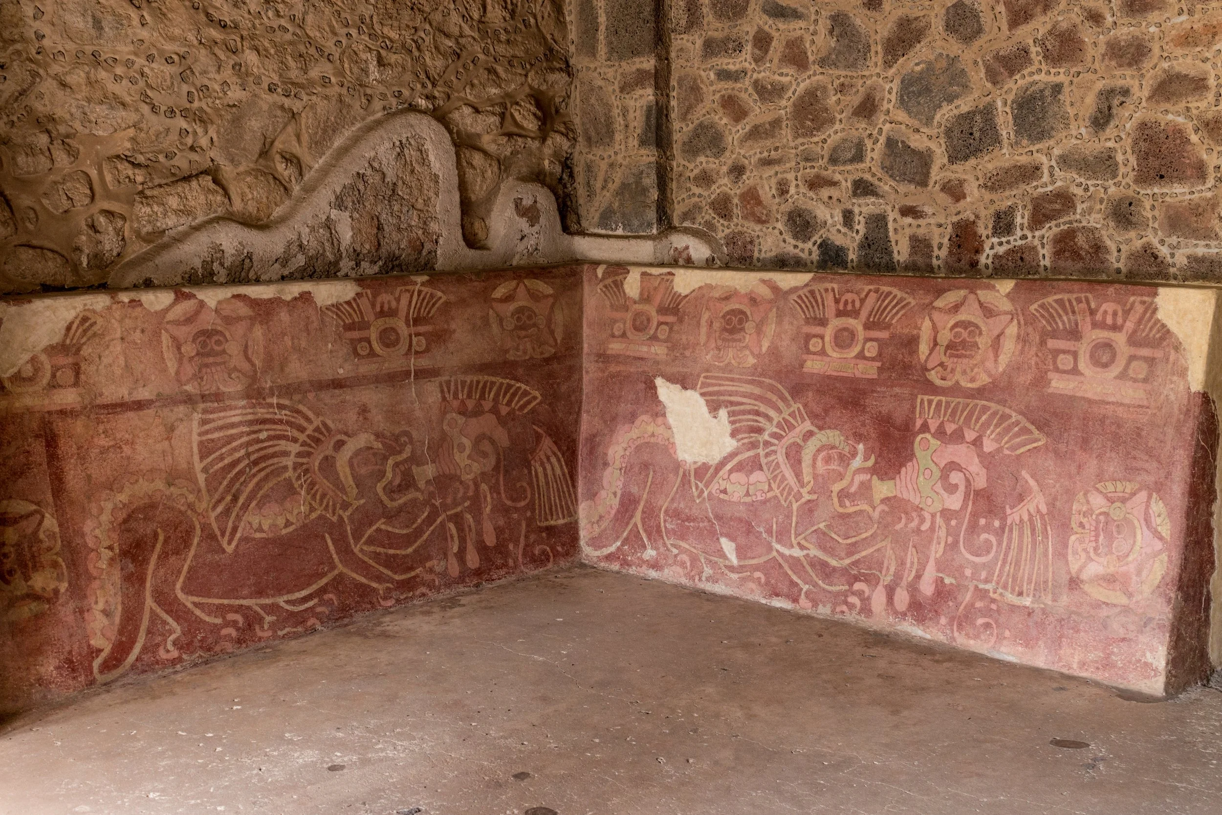
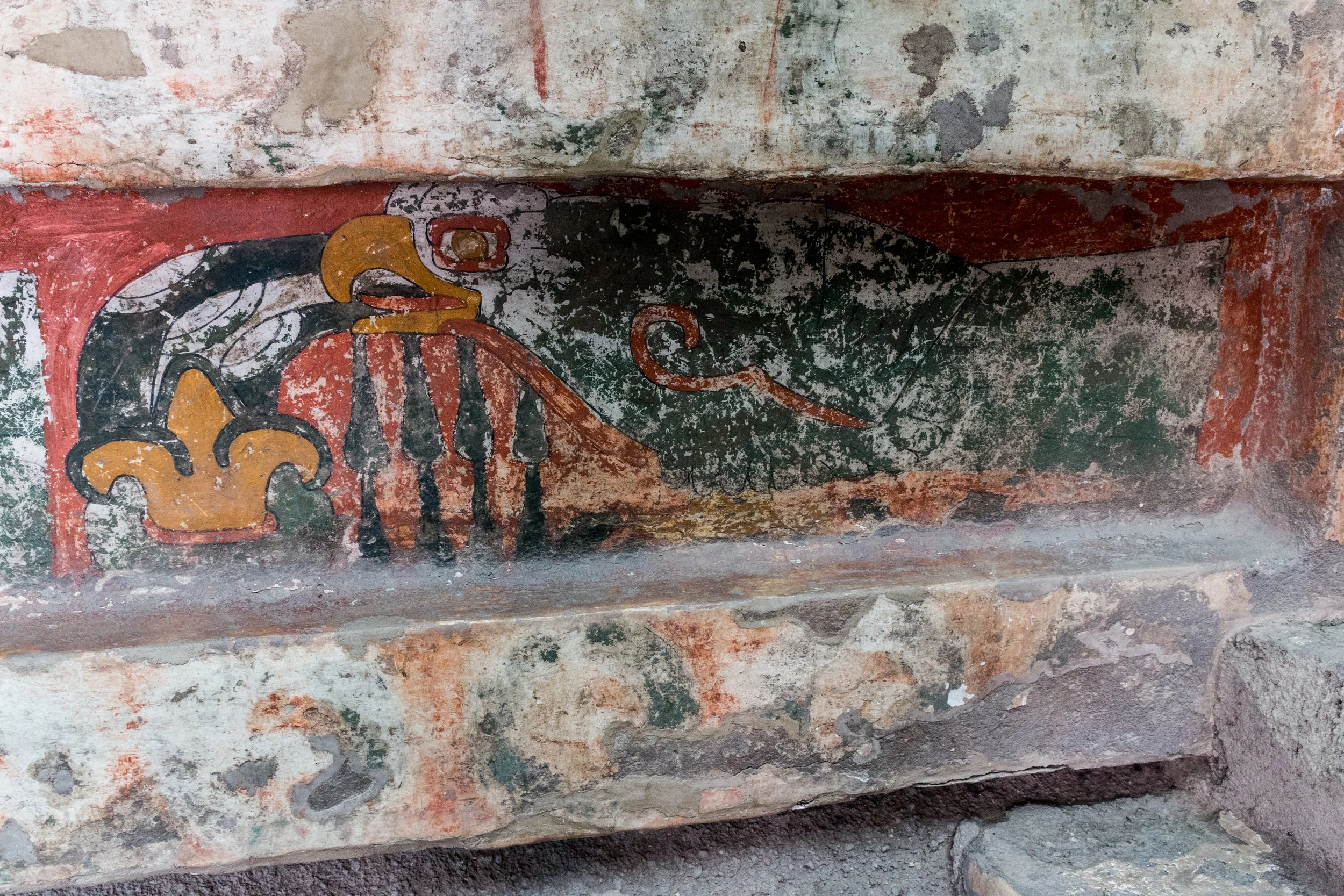
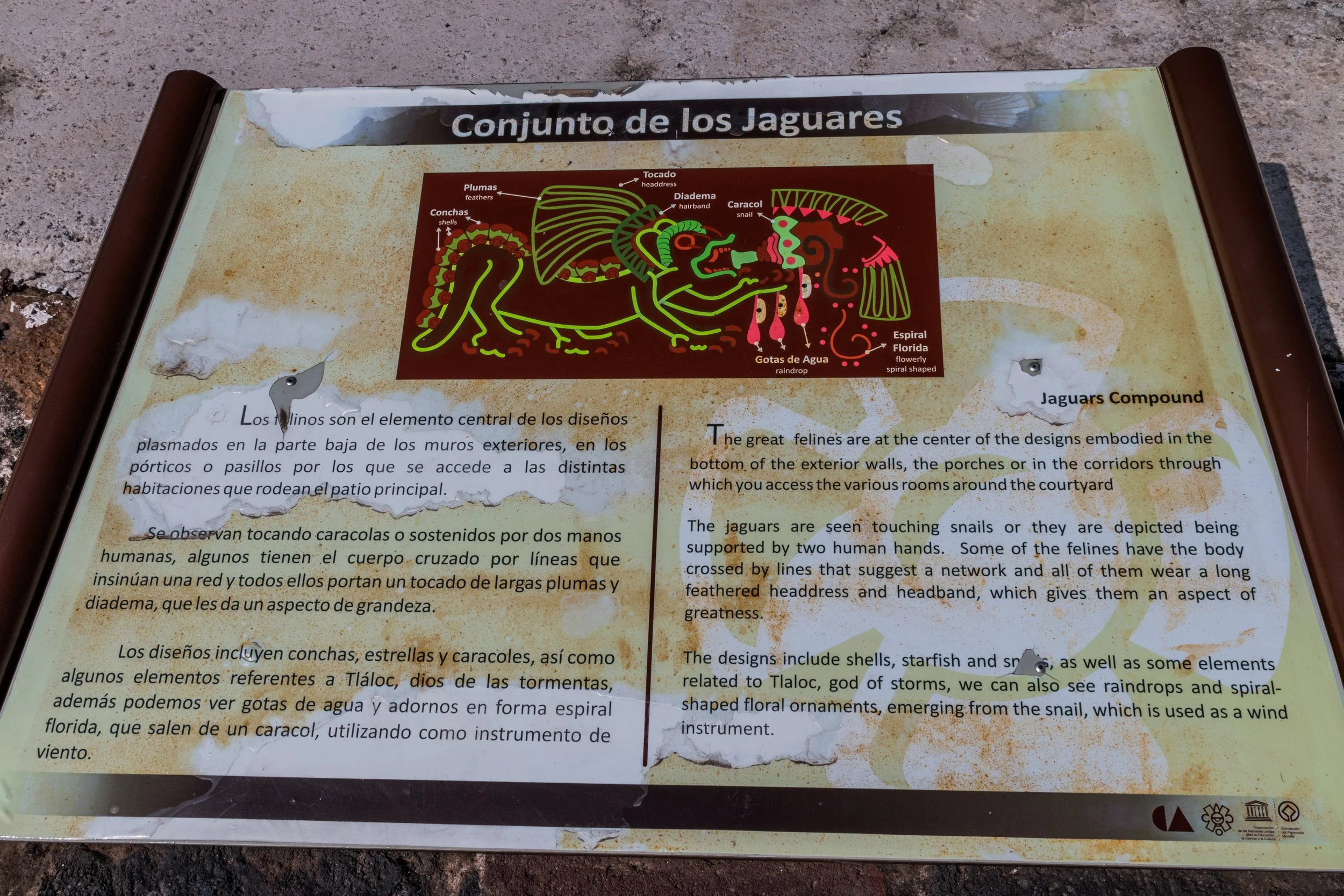
After these two important stops, I spent hours walking around the ruins. Explore the Palace of Quetzlpapalotl. Read all the placards, discover all the hidden paintings of jaguars and then walk down to Templo de Quetzalcóatl before leaving. The temple is easy to miss, but worth the few minutes walk over for the carvings.
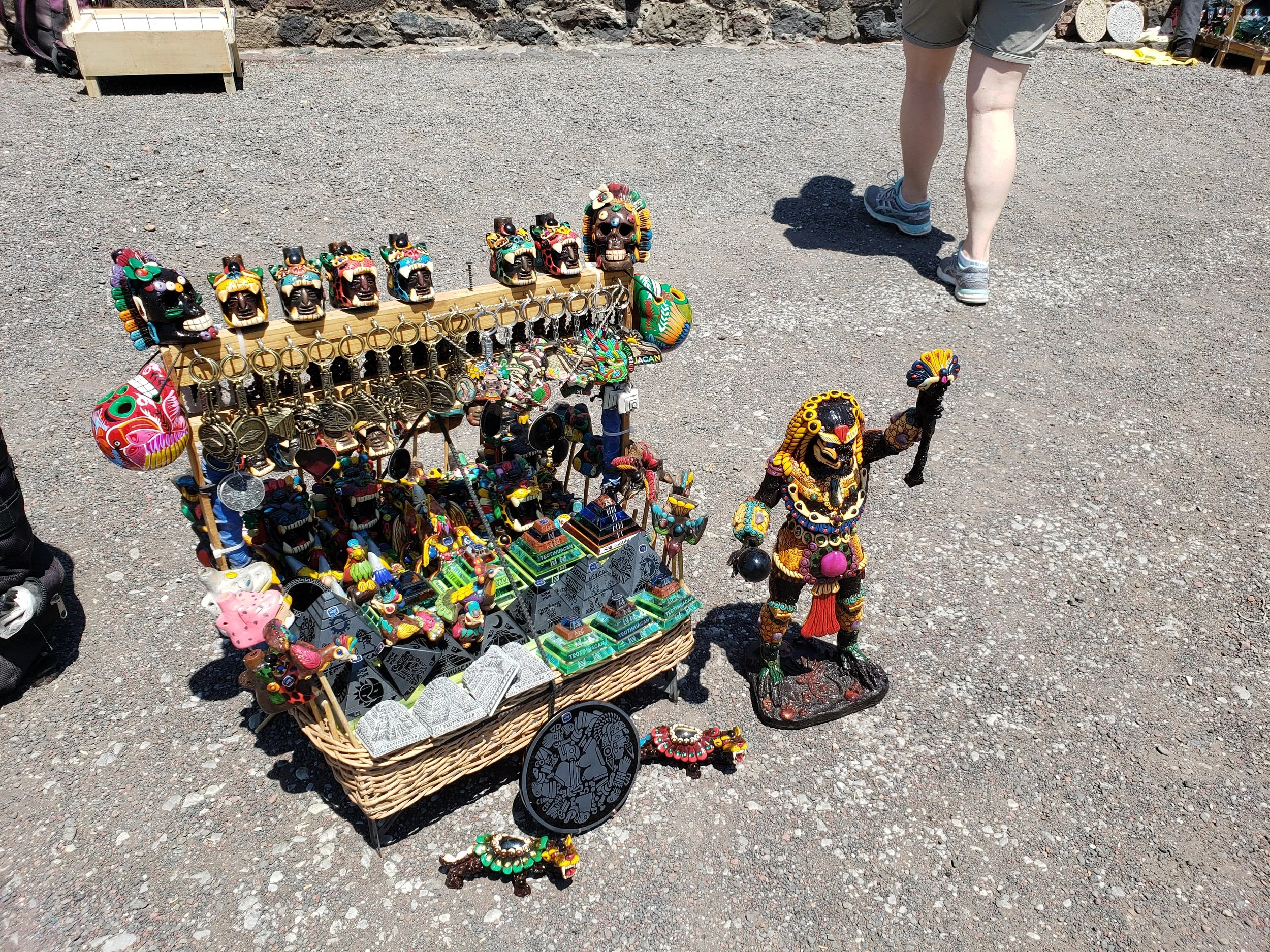
Look out for the hawkers. Some of the jaguar whistles and silver items are decently priced, but barter them down as much as you can. The obsidian statues of the pyramids are of varying quality. I personally purchased a whistle as I liked the paint scheme. But I saw many of these items for sale at the market Mercado de artesanias/la Ciudadela (especially the pyramids).
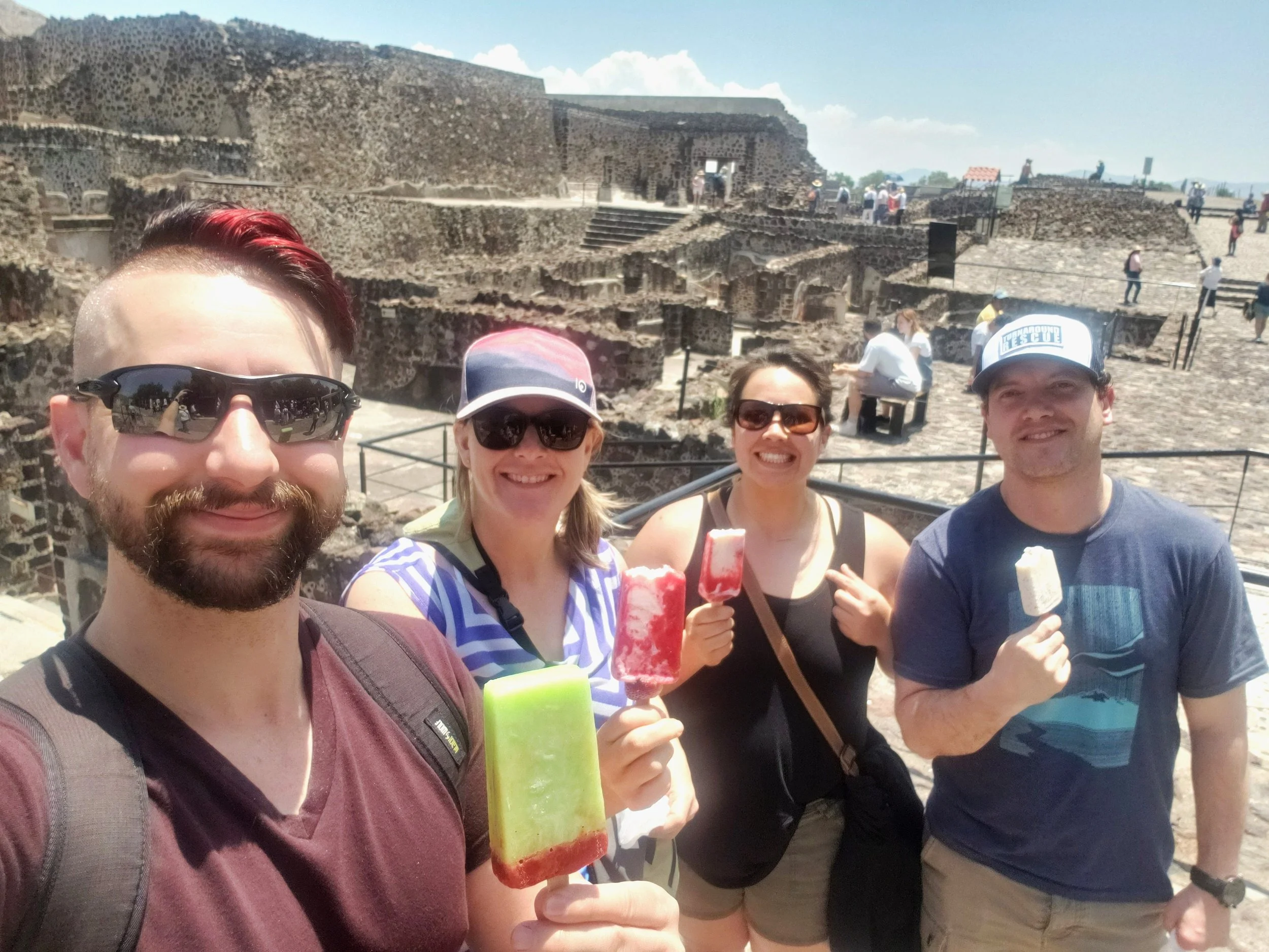
Next to the Palacio de Quetzalpapálotl are some stores where you can buy water and really delicious traditional helados ice creams (strawberries and cream, lemon and chilli). The heat and UV was enough to give me a little sunburn in November.
Avenue of the Dead
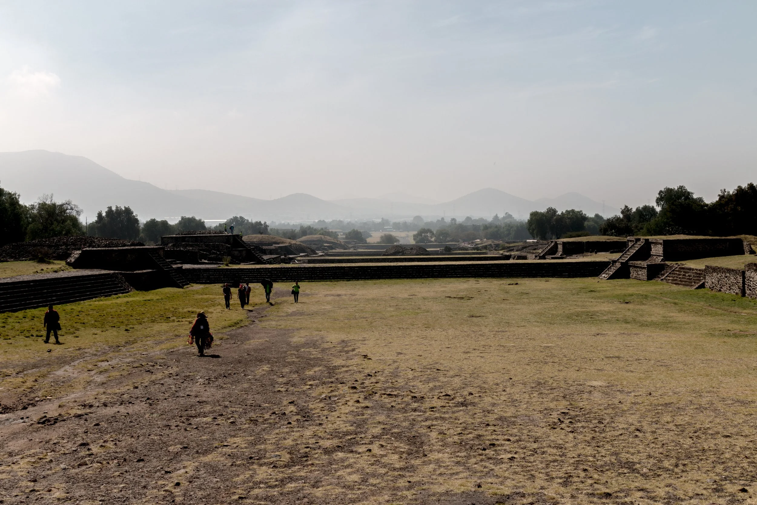
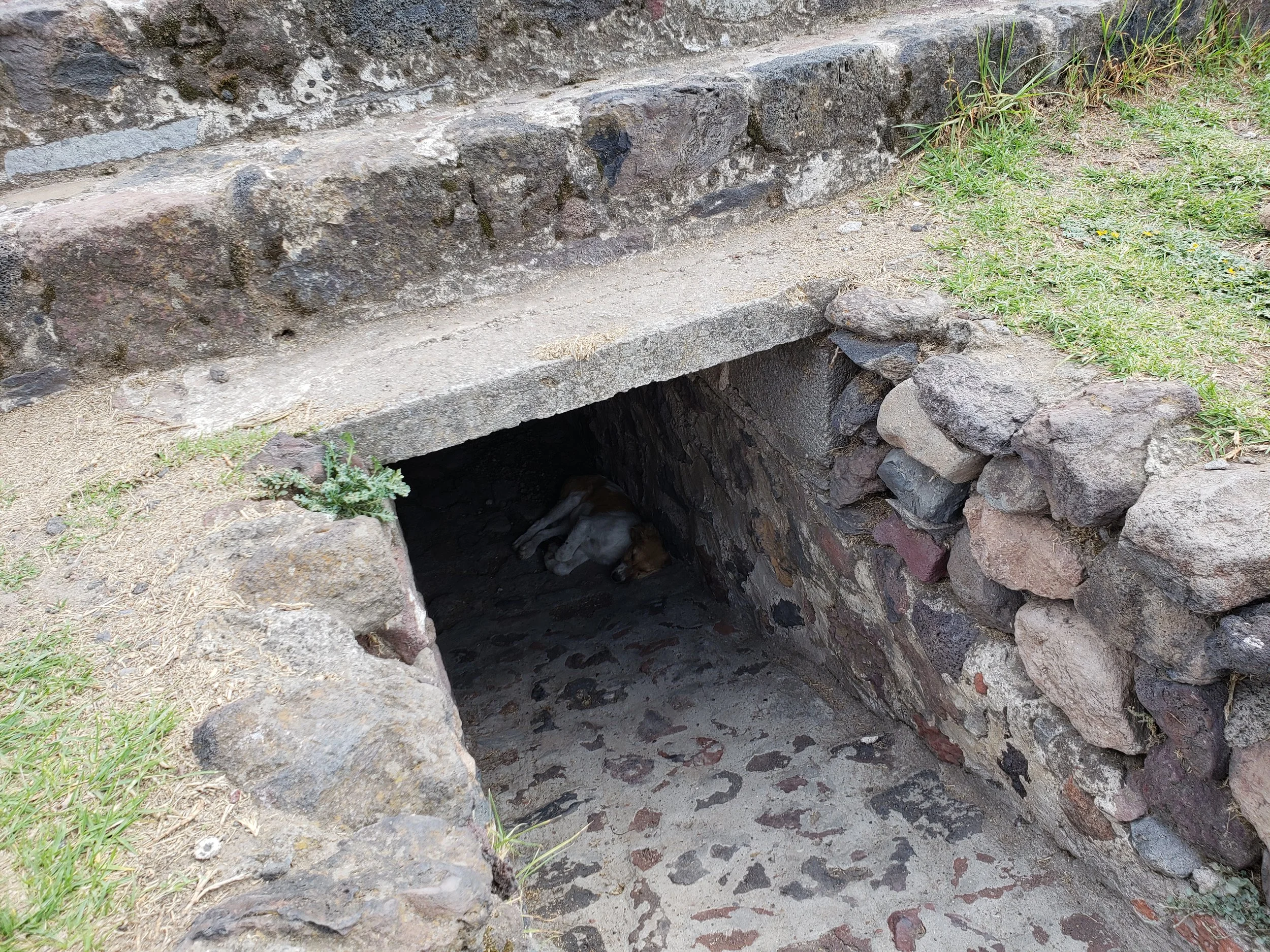
I spent a good 5 hours at the site. I took a lot of photos and even spotted a few crevice swift lizards.
The Citadel and the Temple of Quetzalcoatl
I know people who have taken the dawn balloon rides and have loved it. I have not prioritised this on my trips.
My bus trip back left from almost the same location that I was dropped off at. I didn’t have to cross any roads.
The restaurant in the grotto, named La Gruta, is not somewhere that I have eaten. It is supposed to be stunning but also considered a bit of a tourist trap.